Experiment #Stories.
Back to Lake
... Ask the volcano ... breaking the wall
There's always a friend who thinks he's rockstar
Mini tragedies
It turns out that the infiltrator was killed and mummified.
Radical Manoeuvre
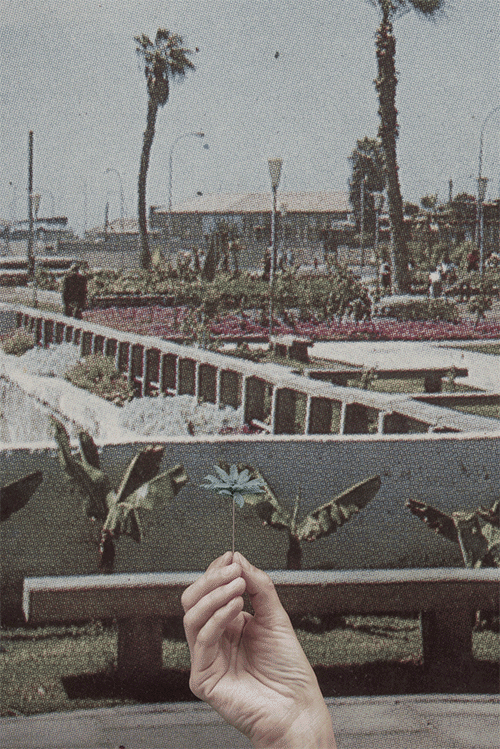
Where saints swim
Attacking the devices
Landscape Render II
With pencil sharpener until the end of the world!
Common places
Jump Over
Here I came up with a micro-story
Playing with the dust between the tree
Is not the best teacher the one who knows the most?
I do not know if it's Chewbacca or La Tigresa del Oriente
I'm not looking for anyone in this city anymore ...
Disunited left and right
The following experiment set out on a quest to imagine images as part of an online system and to interrogate what other kinds of metadata exist in relation to both locations - Iquique and Puerto Varas. How do people describe the images, and which kind of metadata do they write into them? I reviewed the data available from online photography websites, how users make use of the sites by uploading images, but also by creating metadata that can be retrieved and examined. I extracted the titles of publicly available images on Flickr and applied them to images produced during the fieldwork. For this purpose, a program was created which allowed me to read all metadata and titles inside the Flickr platform (I chose Flickr over other images platform such as Instagram because it allows me to retrieve all data automatically) that contained the tag Iquique or Puerto Varas. The script selected the images and generated a text file with a list of titles. Next, the titles from the Flickr images were used to name the images I created during the fieldwork. The combination of images and titles followed an arbitrary logic that emphasised or generated new visual correlations between the image and the title. Most of the titles could be interpreted as general descriptions of the image depicted - a reinforcement of what is seen, for example, "sunset in Iquique". Other titles described the sensation or mood in which the images were taken, such as "radical manoeuvre". These kinds of titles, paired with the garden images, create new meanings by separating them and pairing them with my own fieldwork photographs. The new set of meanings highlights some of the conditions and contradictions found at both sites during the research.
It could be argued that, during the final stages of photographic production, the photographer and the photograph go into a final process of signification where software, norms, and classifications play a fundamental role in the definitions and narratives that the images will play afterwards. As has been explained in the previous section, this process is defined by language and logic established by the XML file associated with the camera’s raw image file or compressed image (tiff, jpg), as well as by the subjective set of classifications created by the photographer. This relationship between image and text, (photograph and metadata or tagging) establishes a new set of relationships.
In this experiment, the combination of images and displaced Flickr titles reflects on the possibilities of creating an interval, and how a new set of different relationships can take place. The indexical tensions between place and meaning are structured into a new set of relationships between place and signifier that are otherwise impossible to juxtapose, with the intention to displace the meaning of each particular image (indexical relation to the real).
Experiment #Impossible
I collected several tourist books and old postcards from a flea market in downtown Santiago. Most of them portray the touristic highlight of each city, such as Playa cavancha, downtown Iquique, the cathedral of Puerto Varas and the view from the city of the Osorno Volcano. So, for this following experiment, I used this collection of postcards aiming to interrogate the online image data available related to the notion of landscape in Chile. For this particular experiment, I searched for those images available through the Google images search engine. With this in mind, I searched using the description phrases retrieved from the found postcards, as keywords - phrases such as; Playa Cavancha, Plaza de Iquique, Catedral de Puerto Varas and Vista del Volcán Osorno, amongst others. Each one of these key phrases was taken from found postcards. From the more than twenty images collected, I choose a few that had a clear location inscription on them. The keywords allowed me to access a set of collections given by the Google algorithm (that is also in part determined by my own search history). From this collection, I chose those images most reproduced by postcards and travel advertising. The final images were manipulated through a set of procedures that allowed me to repeat horizontally through the entire image, the pixels of one vertical line or column. The aim was to re-create the ubiquitous tourist image of both cities with an abstract representation that could potentially question the absent image. In this way, the most common images of Iquique and Puerto Varas disappeared through a coloured line, and a new abstract image emerged. The final images obtained by the set of digital actions were combined with one line containing the keywords used to find it. Images and text create relationships where the absence of the photographic reproduction of the place is replaced by an abstraction that questions the use and reproduction of landscape images in both studied sites.
Going back to the process of making the images and capturing the data, one of the aims of the practice is to foreground the relationship between inputs (data captured), the translation into digital data and the question of how to appropriate this data.
The aim of this experiment was to recreate the image of the landscape, erasing and re-inscribing with partial information about what a landscape image can be. According to the Oxford Dictionary, the criteria to describe something such as a landscape, has two meanings. One, as ‘all the visible features of an area of land, often considered in terms of their aesthetic appeal', but also as ‘denoting a format of printed matter which is wider than it is high: ‘landscape format’’ (Oxford Dictionary, 2017). The relevance, after observing the output, is to see how, by abstracting the image into just lines of colour, a new landscape emerges just by the composition and the horizontal lines, creating a new reconfigured view of the touristic clichés of both places.
Flusser’s photographic program has been key to understanding photographic practice and its influences. This experiment looks at the available resources to try to work with the possibility of writing new programmes that re-create an already seen image of landscape in both places. Looking at the apparatus and its agency I reflect on the use of metadata as a relevant actor in the creation of narratives and works of art. By describing the rationale and references of each experiment, but also what they have in common, I attempt to give a sense of how they have been part of a process that has been evolving along with the theoretical findings. The set of images created, aims to find an alternative image that, by looking at them, I could interrogate how landscape has been perceived in Chile. A decolonial aesthetic which, by reconfiguring a view of the landscape, aims to question those other views that reinforce the perception of the landscape as an empty place ready for exploitation.